Masafi (Masāfī)
Masafi (مسافي) is a village located on the edge of the Hajar Mountains in the United Arab Emirates. It sits at the inland entrance of the Wadi Ham, which runs down to Fujairah City. The border between the emirates of Fujairah and Ras Al Khaimah runs through the town, which houses a barracks used by the United Arab Emirates Armed Forces.
Until relatively recently, with the construction of the Sharjah to Kalba road and the 'truck road' between Dibba and the 311 highway at Ras al-Khaimah, the road through Masafi was the only route from the interior to the East Coast of the UAE. The road from the inland town of Dhaid splits at Masafi, leading to Dibba to the north and Fujairah City to the south.
A number of excavations point to Bronze Age habitation in Masafi, which has a recently restored (2012) stone and adobe fort, smaller but architecturally similar to the nearby Al Bithnah Fort, also restored as part of the same project. The fort encloses an exceptional example of a falaj, an underground waterway constructed to channel water from the mountains to the oasis towns of the interior.
At the turn of the 20th century, Masafi was a village of some 50 houses, with the villagers being split between the Sharqiyin and Mazari tribes, with some 30 cattle, 350 sheep and 5,000 date palms.
Masafi was the site of a rough airstrip used by the Trucial Oman Scouts.
Map - Masafi (Masāfī)
Map


Country - United_Arab_Emirates
 |
 |
| Flag of the United Arab Emirates | |
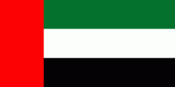
The United Arab Emirates is an elective monarchy formed from a federation of seven emirates, consisting of Abu Dhabi (the capital), Ajman, Dubai, Fujairah, Ras Al Khaimah, Sharjah and Umm Al Quwain. Each emirate is governed by an emir and together the emirs form the Federal Supreme Council. The members of the Federal Supreme Council elect a president and vice president from among their members. In practice, the emir of Abu Dhabi serves as president while the ruler of Dubai is vice president and also prime minister. In 2013, the country had a population of 9.2 million, of which 1.4 million were Emirati citizens and 7.8 million were expatriates. , the United Arab Emirates has an estimated population of roughly 9.9 million.
Currency / Language
| ISO | Currency | Symbol | Significant figures |
|---|---|---|---|
| AED | United Arab Emirates dirham | دإ | 2 |
| ISO | Language |
|---|---|
| AR | Arabic language |
| EN | English language |
| HI | Hindi |
| FA | Persian language |
| UR | Urdu |